Cyclone Alfred: Current Status and Implications
Cyclone Alfred has recently slowed its approach towards the Australian coast, a phenomenon attributed to the absence of significant wind in its vicinity. Michael Barnes, a Research Fellow at Monash University’s ARC Centre for 21st Century Weather, explains that the cyclone is currently in a "stationary environment," leading to a sluggish drift towards the land with minimal winds steering it westward.
As Cyclone Alfred inches closer to shore, its extended stay poses potential concerns for infrastructure and the environment. Typically, cyclones move quickly, delivering intense rainfall, strong winds, and storm surges for about 12 to 24 hours before passing. In contrast, Alfred’s slower progression may prolong these effects, leading to sustained rainfall and wind intensity, which could last beyond 24 to 48 hours in some areas.
Barnes notes that while the cyclone is not inherently more dangerous due to its slow movement, it can increase stress on local conditions. Prolonged rainfall may exacerbate issues such as river flooding, as the accumulated downpour continues over an extended period. Residents along the coastline, particularly in regions such as the Gold Coast, Brisbane, and the Sunshine Coast, should remain vigilant.
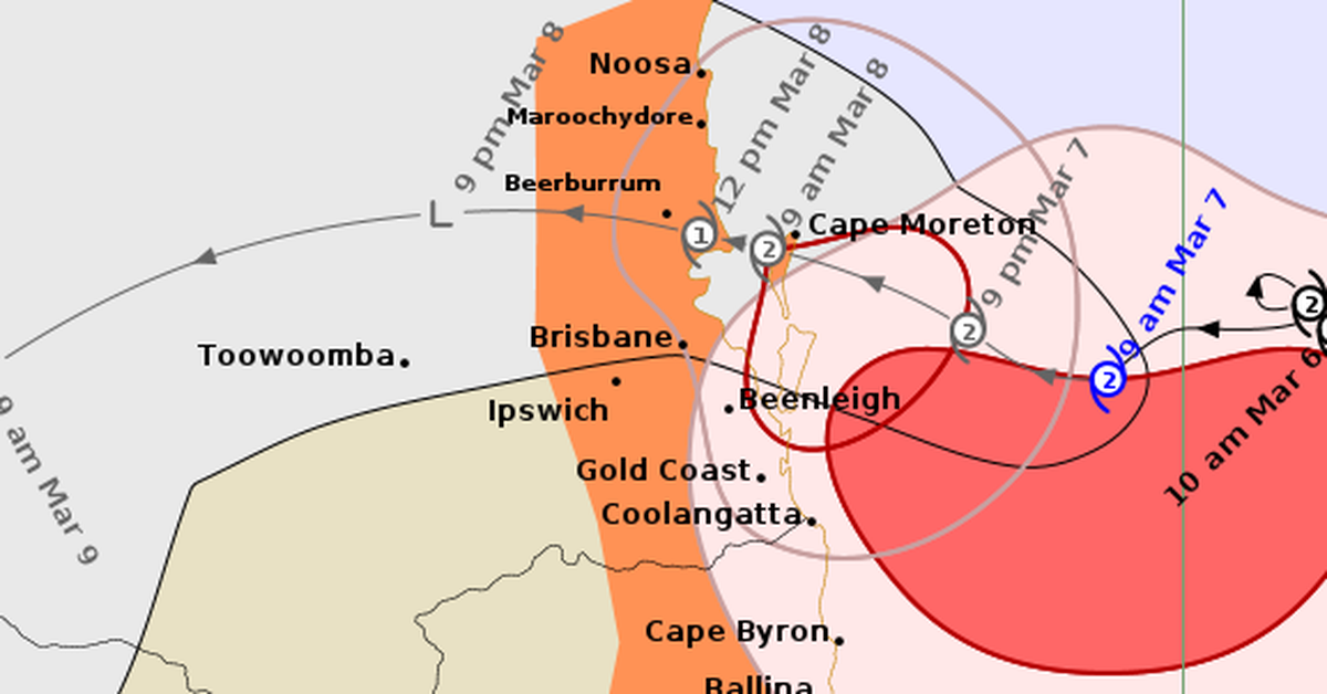
Currently, Cyclone Alfred is situated off the coast of South Queensland and Northern New South Wales, and is anticipated to make landfall later on Friday evening or early Saturday morning—pushed back from earlier predictions. Despite its eventual landfall timing, Barnes emphasises that this is not the only determining factor for its impact. Even after hitting land, the cyclone is expected to maintain heavy rains, strong winds, and rough seas into Saturday.
In summary, Cyclone Alfred’s slow drift towards the Australian coastline poses unique challenges, potentially prolonging the consequences of severe weather systems. Residents should prepare for an extended period of adverse weather, focusing on safety as the cyclone approaches.