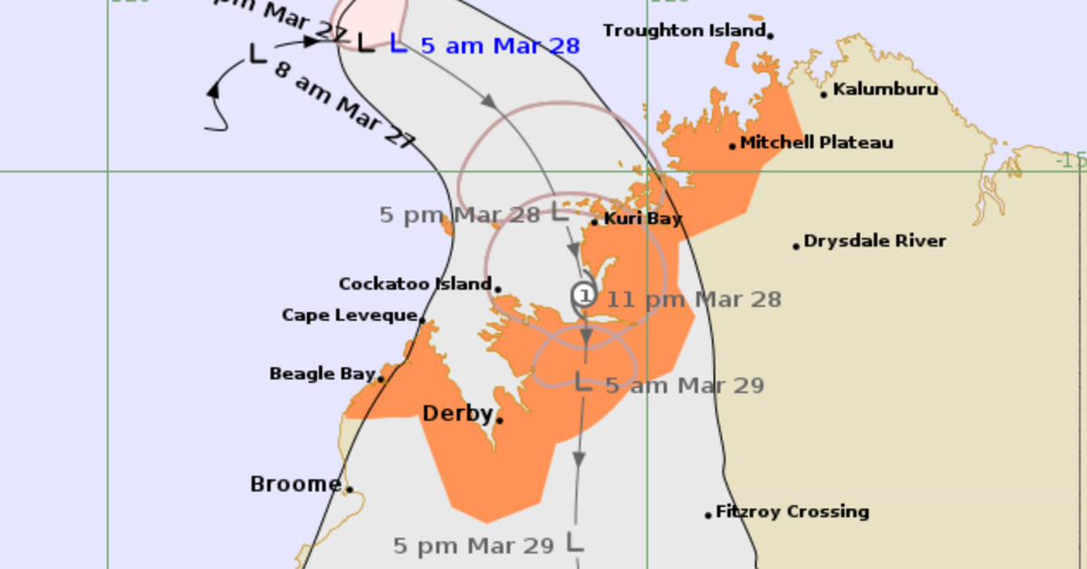
The Bureau of Meteorology has issued a warning regarding a potential tropical cyclone that may impact northern Western Australia tonight. Currently, the storm is classified as a tropical low, progressing eastward at approximately 7km/h towards the northwest Kimberley coast, specifically between Mitchell Plateau and Beagle Bay.
Forecasts indicate that the storm could intensify to tropical cyclone levels shortly before it makes landfall, anticipated late tonight or early tomorrow morning. This morning, the storm was last observed 270 kilometres northwest of Kuri Bay and 405 kilometres north-northwest of Derby, with recorded sustained winds reaching 65km/h and gusts up to 95km/h.
The cyclone is projected to cross the coast north of Derby, between Kuri Bay and Cape Leveque, bringing damaging wind gusts of around 100km/h to coastal regions. Additionally, residents can expect heavy rainfall, which poses a risk of flash flooding across the northern and western Kimberley areas starting Friday and continuing into the weekend.
As the cyclone moves inland on Saturday and Sunday, it is expected to weaken, according to the Bureau’s report issued at 2am local time. Current weather warnings are active from Mitchell Plateau to Beagle Bay, encompassing Derby.