A significant clean-up operation is currently underway in various suburbs of Perth, following severe weather that has been attributed to a suspected tornado. This event has led to uprooted trees and flash flooding across the region.
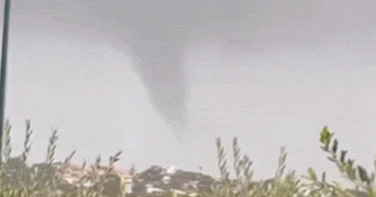
Footage recorded during the early afternoon captured a distinctive cloud formation looming over the city; however, the Bureau of Meteorology has yet to officially confirm whether it was indeed a tornado. Senior meteorologist Miriam Bradbury noted that while the footage displays a funnel-like cloud, it’s still undetermined if it resulted from a tornado, a waterspout, or a different atmospheric phenomenon.
Experts are set to conduct a thorough analysis of the aftermath, as tornadoes typically leave behind recognisable patterns in the destruction they cause. Bradbury emphasised a crucial point: thunderstorms, even those that do not escalate to the level of producing tornadoes, can still generate strong, unpredictable winds capable of causing significant damage.
The region experienced a powerful cold front that swept through on the same day, bringing with it intense rainfall, hail, and gusty winds. Wind speeds reached over 87 km/h on Rottnest Island, with Perth Airport recording gusts of 72 km/h and Gooseberry Hill seeing 69 km/h. In South Perth, rainfall hit as high as 71 mm by 6 am today, with City Beach identified as one of the hardest-hit areas.
Reports indicate that a luxury home lost its roof during the storm, while another property suffered a caved-in garage as a result of the severe weather. Officials are urging motorists to exercise caution, especially in areas where fallen trees and power lines pose hazards, and to be mindful of other debris resulting from the storm.
Overall, the community is rallying together as the clean-up progresses, amid ongoing assessments of the damage and the unpredictable nature of the recent weather.