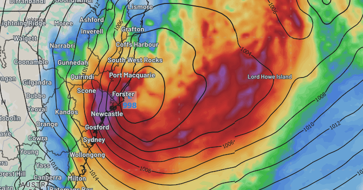
Eastern New South Wales (NSW) is bracing for severe weather as a potential east coast low approaches the region. Anticipated to impact the Mid North Coast today, the most intense conditions are expected in Sydney by tomorrow. The Bureau of Meteorology has issued warnings for hazardous winds and surf along the NSW coastline.
Additionally, a flood watch has been issued for several catchments, including the Hawkesbury-Nepean, Georges River, Cooks River, Sydney Coast, and Illawarra Coast. This developing weather system, referred to as a potential “bomb cyclone,” is characterised by its rapid intensification, posing serious threats in a matter of days. This event could mark the first east coast low to affect Sydney since 2022.
Initial weather patterns indicate some rain and wind today, but the situation is set to worsen significantly tomorrow, particularly in Sydney, where rainfall could reach up to 90mm within a 24-hour period. Sustained winds are forecast at speeds of 45km/hr, with gusts potentially reaching 125km/hr, as advised by the Bureau.
The New South Wales State Emergency Service (SES) has urged residents from Bega to Coffs Harbour to prepare for challenging conditions. It is advisable for the public to remain informed about the latest warnings and updates by checking the Bureau of Meteorology and SES websites.