Mount Lewotobi Laki Laki, one of Indonesia’s most active volcanoes, erupted for the second consecutive day on Saturday, releasing a towering column of volcanic ash and debris that reached an altitude of 18 kilometres. The eruption covered nearby villages in volcanic materials; however, no casualties have been reported thus far.
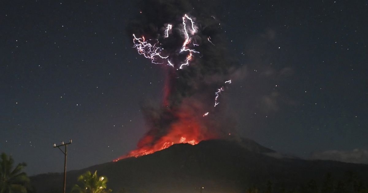
The previous eruption occurred on Friday night, generating ash clouds that ascended to 10 kilometres and illuminating the sky with glowing lava and lightning strikes. Both eruptions transpired within a five-hour window. Indonesia’s Geology Agency documented a significant flow of gas clouds and lava, travelling up to 5 kilometres down the mountain’s slopes.
Drone footage indicated substantial magma movements, leading to tremors detected by seismic sensors. Volcanic debris, including heated gravel, was propelled up to 8 kilometres from the crater, blanketing the surrounding areas. Officials have warned locals to remain vigilant, particularly towards potential heavy rainfall that could exacerbate lava flows in rivers originating from the volcano.
Saturday’s events marked one of the most significant eruptions Indonesia has witnessed since 2010 when Mount Merapi’s eruption resulted in over 350 fatalities on Java, prompting large-scale evacuations. This latest eruption follows closely after a major event on July 7, which disrupted numerous flights at Bali’s Ngurah Rai airport and left roads and farmlands coated in thick volcanic ash.
Mount Lewotobi Laki Laki, standing at 1584 metres on the eastern island of Flores, has been on high alert since its initial eruption on June 18. In response to ongoing volcanic activity, the exclusion zone around the volcano has been expanded to a 7-kilometre radius. The Indonesian government has previously relocated thousands of residents following a series of eruptions in November that resulted in nine deaths and the destruction of thousands of homes.
Indonesia, home to over 280 million people, is a geologically active archipelago with 120 active volcanoes. It is situated along the “Ring of Fire,” a region notorious for its seismic activity, characterised by a series of fault lines encircling the Pacific Basin.