Millions of residents in Queensland and northern New South Wales are on high alert as Tropical Cyclone Alfred approaches, with predictions indicating it could make landfall within the next 72 hours. Over 4 million individuals from Sandy Cape to Grafton have received warnings as the cyclone is expected to bring heavy rains, strong winds, and the potential for flash flooding by week’s end.
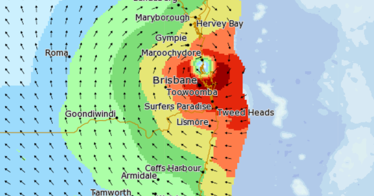
The Bureau of Meteorology forecasts that Cyclone Alfred is likely to strike the southeast Queensland coast either late Thursday or early Friday morning, categorised as a level 2 storm. Wind gusts could reach up to 120 km/h starting Wednesday, with significantly heavy rainfall that may result in daily totals of 200 to 400 millimetres leading to flash floods.
Residents are advised to stay informed about the storm’s path via the Bureau of Meteorology website, where live updates and tracking maps are available. The cyclone is projected to primarily impact the southeast Queensland coast and certain areas in northeastern New South Wales, with significant threat zones including Brisbane, Gold Coast, Sunshine Coast, and Byron Bay.
When Cyclone Alfred reaches Brisbane, it is anticipated to bring damaging winds and intense weather conditions, posing serious risks. As of Tuesday, the cyclone was situated around 560 kilometres east of Brisbane, packing wind gusts of up to 130 km/h. The Bureau is closely monitoring its approach.