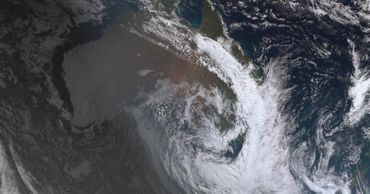
This weekend, regions across Queensland, New South Wales, Victoria, and Tasmania are facing dark and drizzly weather, with rain predicted for all states and territories. A significant crescent-shaped storm system is positioned above the East Coast, making its mark visible from space.
Meteorological experts have indicated that while rain will be widespread, it is not expected to lead to flash flooding or severe weather conditions. Angus Hines, a senior meteorologist with the Bureau of Meteorology, highlighted that the key aspect of this weather pattern is its broad coverage rather than the intensity of rain at any specific location. Originating from Western Australia a few days ago, this moisture-laden front has now swept through South Australia and is impacting eastern states, stretching notably from northern Queensland to southern Tasmania.
Most areas will receive light rainfall, but central Queensland and Tasmania are anticipated to see the heaviest downpours. Hines reassured that while some regions might experience a bit of rain, there are no significant concerns for severe weather, indicating that for many, this precipitation is a welcome change, especially in places that have been dry for an extended period.
In Victoria, snowfall is adding to the weekend’s wintery atmosphere. Mt Buller has recorded 21 centimetres of snow, although conditions have improved following gusty winds that reached speeds of 140 kilometres per hour overnight. Snow enthusiasts have been advised to drive cautiously in these conditions.
Overall, as this weather system passes through, it brings much-needed moisture to areas that have been deprived of rain for a considerable time, while also enhancing winter conditions in the Alps.