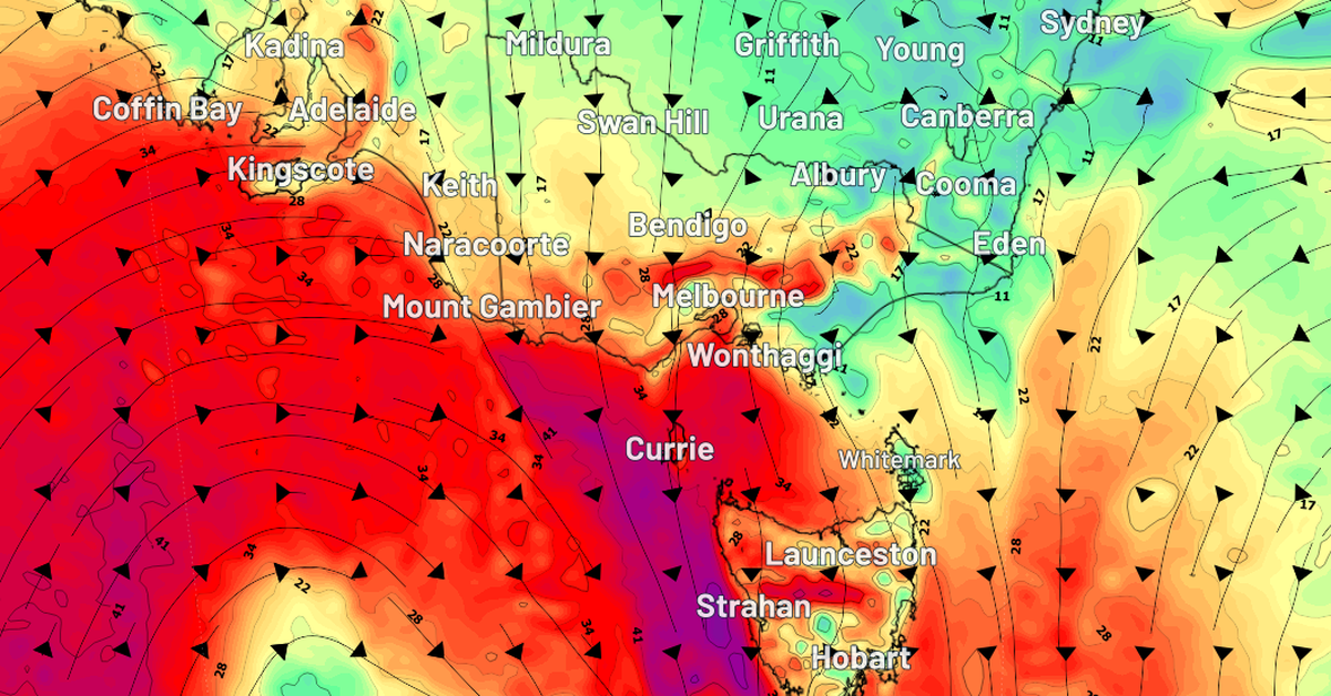
A cold front is set to impact south-eastern Australia early this week, bringing with it a mix of rain, snow, and strong winds. According to Weatherzone, South Australia will bear the brunt of these weather conditions today, with wind gusts ranging from 50 km/h to 75 km/h in Adelaide and the Mount Lofty Ranges.
In contrast, Victoria is expected to experience even stronger gusts, reaching between 70 km/h and 85 km/h, with some areas potentially seeing winds close to 90 km/h. While Melbourne may see slightly lower gust speeds of 60 km/h to 75 km/h, this next phase of severe weather will extend through tomorrow for Victoria, Tasmania, and south-eastern New South Wales, where alpine regions may register similar high winds.
Showers are anticipated to sweep across most areas, with some districts possibly facing isolated thunderstorms that could lead to rainfall totals between 20 mm and 50 mm. Snow is forecasted for the alpine regions late Monday night, with expected falls of 10 cm to 15 cm by late Tuesday or early Wednesday. Weatherzone advised that these winds may create momentary white-out conditions and reduced visibility, making skiing less than ideal, although the new snowfall will help maintain a solid base at ski resorts.
As the week progresses, a ridge of high pressure will move in from the west, gradually softening the winds and granting sunnier, calmer weather through to Saturday. This shift will provide skiers with a perfect opportunity to enjoy the new snow once conditions improve.