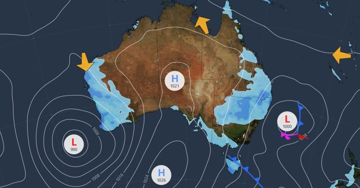
Australia is set for a spell of chilly and wet weather this week, with significant rainfall expected in Perth. The city is bracing for more rain on Tuesday and Wednesday, following a wet start from the previous day. Over a three-day stretch, total rainfalls could reach up to 50mm. This downpour marks the heaviest for 2025, coming after a period of below-average rainfall since the year’s beginning. Fortunately, while the rains will continue for a short while, temperatures will remain relatively mild.
In addition to Perth’s conditions, a cold front is making its way across the east coast of Australia today, heralding the first significant chill of winter. The lowest temperatures of the year are anticipated in northern and western New South Wales, as well as southern regions of Queensland. This cold front is expected to extend northward, potentially bringing rains to northeastern NSW as it moves.
The alpine areas may see some snow, with forecasts suggesting a few centimetres during this period. As the week progresses, a polar air mass is likely to sweep into southeastern Australia, possibly resulting in heavy snowfall in the higher elevations of the mainland’s alpine regions. While there is excitement among snow enthusiasts, Weatherzone cautions that such systems can be unpredictable, and the extent of snowfall may vary. Overall, the markers indicate the arrival of the snow season may coincide with consistent snowfall beginning next week.